
 It can be tricky to take care of the daily run when I’m traveling. At home, I know a collection of well-worn routes. I know their quirks and advantages. I know where I’ll have to wait for traffic lights, and where I can avoid them. I know where all the imaginary mile markers are.
 A foreign territory deprives me of all that - but it also liberates me from it. I don’t have to worry about getting my "mileage" in, or my pace goals, I can just pick a general direction, and go for a run. It’s a cool way to see a new place. It’s an exploration adventure.
I’ve found that the easiest thing to do is take a quick look at a map to pick a direction. That way I can try to avoid unexpected dead-ends, and will have a general route long enough for a good out-and-back. Then I pick a time for the “out” leg – say 20 minutes – and head out to see what I see.
I’ve done this in a lot of places over the years: Rochester, NY; rural, western Michigan; the suburbs of Nashville; the Quad Cities in NW Illinois; and even along California’s Pacific coast somewhere south of San Gregorio. Last week, I got to explore the suspended views of Brooklyn and Lower Manhattan.
I started in Brooklyn Heights, near the Brooklyn Bridge, which, famously, has a footbridge that runs above the lanes of auto traffic. The first day, I ran one of my out-and-backs across that bridge into Manhattan. The pedestrian traffic on the sidewalks near city hall was a little tricky to navigate, but it was a lot of fun running over the old bridge and back.
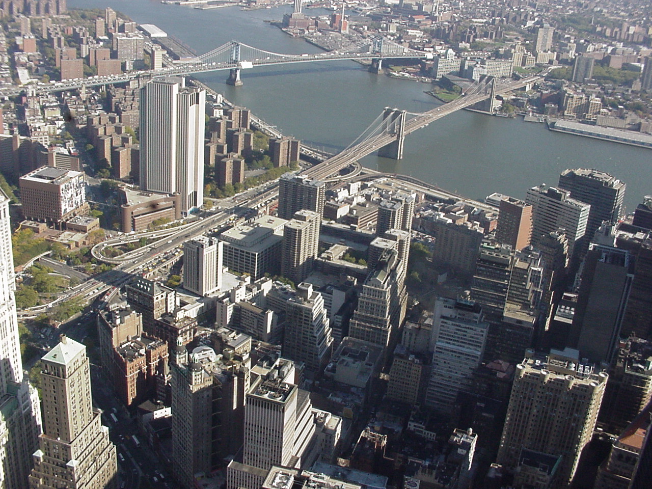 The next day, I decided to get more creative. The Brooklyn Bridge gets all the press, but the Manhattan Bridge crosses the East River right next door, just a little to the north. I wasn’t too sure what the overall distance would be, but I plotted out a big loop course that would take me over both bridges and return me whence I came.
 It was great! I followed the same path as the day before up and over the Brooklyn Bridge, then followed the city streets in Manhattan north to Chinatown and then east again to the foot of the Manhattan Bridge, where I followed the street signs to the pedestrian walkway along its south side.
Both bridges are massive and majestic. (The Brooklyn Bridge opened in 1883, and the Manhattan Bridge in 1909.) They each arc high over the East River and offer stunning views of both the boroughs. But the footpath on the Brooklyn Bridge is suspended above the cars, exactly in the center of the bridge. When you peek over the edge of the walkway, you see cars just below you. On the Manhattan Bridge, however, the walkway is on the outer edge of the bridge, and there is little more than a short cement wall and curved fence that separates you from the drop to the river 150 feet below. It’s perfectly safe, but impressive nevertheless.
I’ve done travel runs in New York City before, but they were mostly along the bike path along the west side of Manhattan beside the Hudson River. It’s a nice, long path, but a little bit boring. This double bridge route was fun, scenic and quick.
There’s just no better way to get to know a new place than to get out on your own two feet and explore. I often tell people how nothing about New York made much sense to me until I ran the NYC Marathon through all five boroughs. It was great to put a few more pieces of the city together with my running shoes on.
No comments:
Post a Comment